|
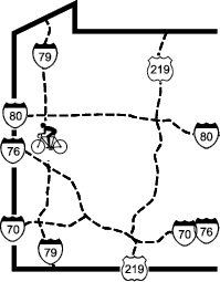
Moraine State Park (Lake Arthur) Bike Trail |
one moment while we fetch a trail picture
|
|
|
Moraine State Park (Lake Arthur) Bike Trail |
one moment while we fetch a trail picture
|
During the ice age 14,000 years ago, the Wisconsin Ice Sheet came just this far south, where it dammed Muddy Ck to create a large glacial lake. When the glacier receded the lake burst, and the water it liberated carved the deep gorge a few miles west on Slippery Rock Ck, making major changes to the regional drainage patterns. Geological remnants of glaciation, including the moraine and an esker can still be found in the area. Present-day Lake Arthur is in approximately the same location as the glacial lake.
More recently, this area has been exploited for its minerals: first oil in the late 19th century, then coal. Deep mines predominated in the early 20th century, and the area was strip-mined in the 1940s and 1950s.
A park was proposed in 1951 when a geological survey revealed traces of the glacial lake. Extensive restoration was required to reclaim the land that is now the park. Deep mines were sealed, hundreds of oil and gas wells were plugged, and strip mines were re-contoured. The park opened in 1970.
The McDanels Launch Area has a tour boat operation that has a 1.5 hour tours of the lake. Reservations required, The boat can be booked for parties. For detatils see
https://morainepreservationfund.org/activities/boat-tours-cruises/